Brick Kiln Farm Bridge
Introduction
The photograph on this page of Brick Kiln Farm Bridge by David Tyers as part of the Geograph project.
The Geograph project started in 2005 with the aim of publishing, organising and preserving representative images for every square kilometre of Great Britain, Ireland and the Isle of Man.

There are currently over 7.5m images from over 14,400 individuals and you can help contribute to the project by visiting https://www.geograph.org.uk
Brick Kiln Farm Bridge
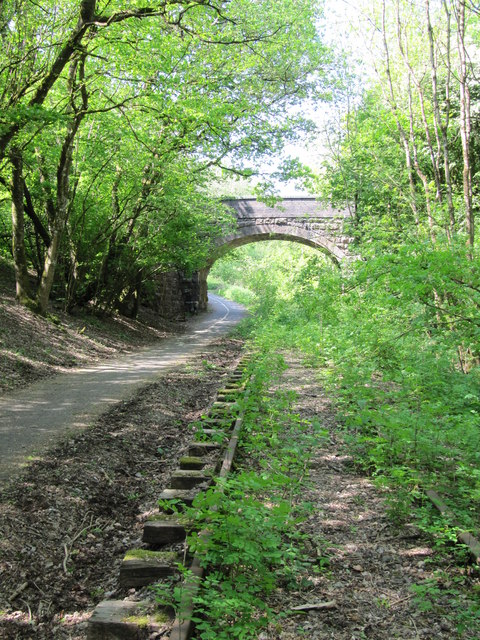
Image: © David Tyers Taken: 2 May 2011
Bridge carrying Wanwards Lane across the Frome to Radstock railway (closed to passenger traffic in 1959, and to goods in 1968). It now crosses The Colliers Way (part of National Cycle Network Route 24), though the overgrown railway tracks are still in place.
Images are licensed for reuse under creativecommons.org/licenses/by-sa/2.0
Image Location


Leaflet Map data © OpenStreetMap
Latitude
51.251606
Longitude
-2.381373