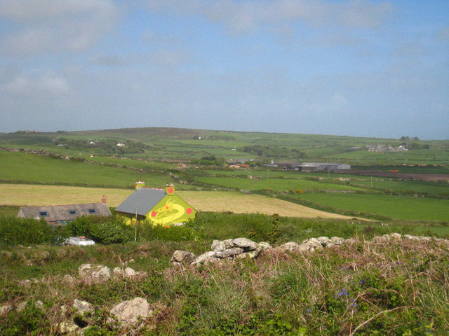
Bolankan House
Introduction
The photograph on this page of Bolankan House by Rod Allday as part of the Geograph project.
The Geograph project started in 2005 with the aim of publishing, organising and preserving representative images for every square kilometre of Great Britain, Ireland and the Isle of Man.
There are currently over 7.5m images from over 14,400 individuals and you can help contribute to the project by visiting https://www.geograph.org.uk

Image: © Rod Allday Taken: 8 May 2011
This house in a prominent position on the east slope of Chapel Carn Brea and very visible from the A30 below had for many years the Yin Yang symbol painted on the south facing roof slope. The roof has recently been re-slated and the south slope (not visible in this photo) is now almost entirely covered by an array of photovoltaic cells. However, it's interesting to see that the owner's apparent interest in things oriental is now evidenced by the huge Chinese dragon painted on the gable end. Also visible in the photo are the farmsteads of Tredinney and Brane, centre right and far right respectively. The summit on the horizon above the house is Caer Bran in square Image

