Castle remains at Bewcastle
Introduction
The photograph on this page of Castle remains at Bewcastle by Les Hull as part of the Geograph project.
The Geograph project started in 2005 with the aim of publishing, organising and preserving representative images for every square kilometre of Great Britain, Ireland and the Isle of Man.

There are currently over 7.5m images from over 14,400 individuals and you can help contribute to the project by visiting https://www.geograph.org.uk
Castle remains at Bewcastle
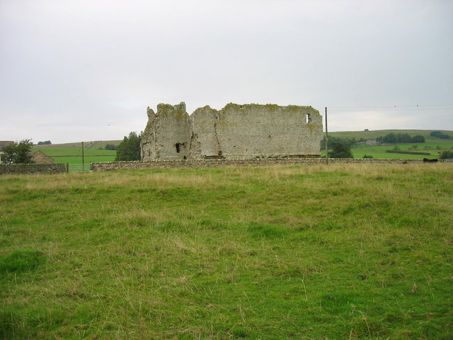
Image: © Les Hull Taken: 13 Sep 2006
Bewcastle Web Site: A castle was built soon after 1092, using part of the Roman ditch system and probably constructed of timber. The present stone castle was built, using material from the Roman fort, by one of Edward III's generals, John de Strivelyn between 1340 & 1360. Falling into disrepair under the de Middleton family, it was thought to have been repaired by the Warden of the English West March, the Duke of Gloucester, later Richard III. From the late 15th Century till 1608, it was held for the crown by the Musgraves, who acted as constables. Abandoned around 1640, it was demolished, probably through the time-honoured fashion of pinching the stone for local housing. Until recently the walls were considered unsafe: during 2003 and 2004 English Heritage consolidated and pointed the walls, while trial excavations uncovered part of the courtyard and an internal doorway. To protect against weather, these excavations have been filled in. Access to the fort is free of charge, though unsupervised. We regret that steepness of the defensive ditches and the soft ground make access for those with special needs difficult. A descriptive booklet is available from the nearby farm. Please do not climb on the walls or allow children to do so.
Images are licensed for reuse under creativecommons.org/licenses/by-sa/2.0
Image Location


Leaflet Map data © OpenStreetMap
Latitude
55.064865
Longitude
-2.681076