River Itchen at Winnall Moors
Introduction
The photograph on this page of River Itchen at Winnall Moors by Caroline Maynard as part of the Geograph project.
The Geograph project started in 2005 with the aim of publishing, organising and preserving representative images for every square kilometre of Great Britain, Ireland and the Isle of Man.

There are currently over 7.5m images from over 14,400 individuals and you can help contribute to the project by visiting https://www.geograph.org.uk
River Itchen at Winnall Moors
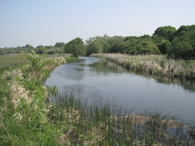
Image: © Caroline Maynard Taken: 30 Apr 2011
Looking up the main stream of the River Itchen as it flows through the northern section, usually closed to the public, of the Winnall Moors nature reserve. Note that the river is higher than the adjacent fields. All of the streams of the river were canalised as they flowed through Winchester, and raising the level made it easier to flood the meadows when desired.
Images are licensed for reuse under creativecommons.org/licenses/by-sa/2.0
Image Location
Latitude
51.074153
Longitude
-1.298687