Holy Trinity North Fambridge
Introduction
The photograph on this page of Holy Trinity North Fambridge by Joan Kent as part of the Geograph project.
The Geograph project started in 2005 with the aim of publishing, organising and preserving representative images for every square kilometre of Great Britain, Ireland and the Isle of Man.

There are currently over 7.5m images from over 14,400 individuals and you can help contribute to the project by visiting https://www.geograph.org.uk
Holy Trinity North Fambridge
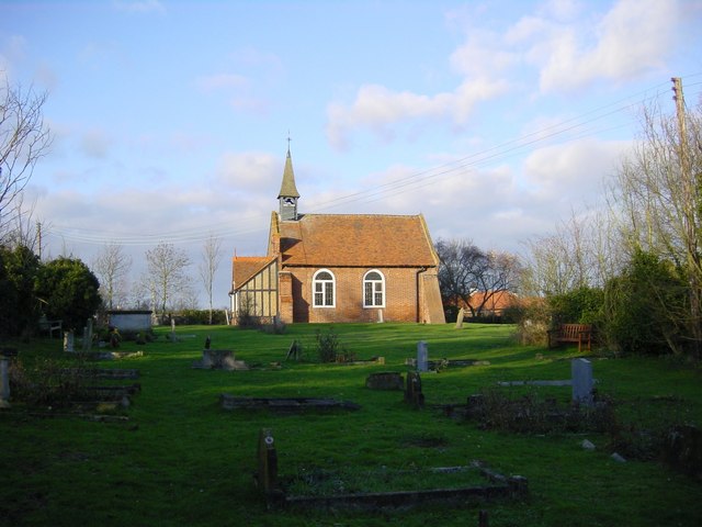
Image: © Joan Kent Taken: 18 Dec 2004
Holy Trinity nestles in the rural parish of North Fambridge, Essex, in the Dengie peninsula approximately 48 miles east of the centre of London. It is one of two parishes at Fambridge, South Fambridge being on the other side of the tidal River Crouch. Surrounded by farmland, North Fambridge is adjacent to the Essex Wildlife Trust site of Blue House Farm.
Images are licensed for reuse under creativecommons.org/licenses/by-sa/2.0
Image Location
Latitude
51.642299
Longitude
0.670852