St Breward: by Lower Lank Cottage
Introduction
The photograph on this page of St Breward: by Lower Lank Cottage by Martin Bodman as part of the Geograph project.
The Geograph project started in 2005 with the aim of publishing, organising and preserving representative images for every square kilometre of Great Britain, Ireland and the Isle of Man.

There are currently over 7.5m images from over 14,400 individuals and you can help contribute to the project by visiting https://www.geograph.org.uk
St Breward: by Lower Lank Cottage
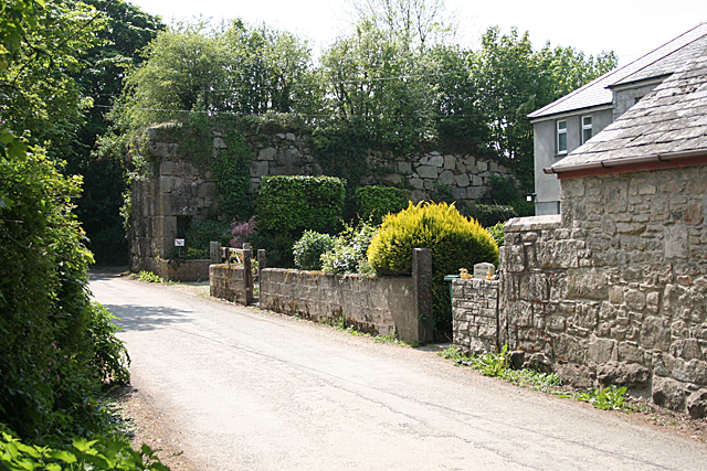
Image: © Martin Bodman Taken: 4 May 2011
Embanked incline plane and granite abutment for now vanished bridge over lane at Lower Lank, St Breward parish. The embankment was part of a tramway connecting the De Lank quarries with Wenfordbridge in the Camel valley below, where it connected with a branch of the Bodmin and Wadebridge railway. In St Breward parish
Images are licensed for reuse under creativecommons.org/licenses/by-sa/2.0
Image Location
Latitude
50.543968
Longitude
-4.696121