Cook's Kitchen Mine
Introduction
The photograph on this page of Cook's Kitchen Mine by Chris Allen as part of the Geograph project.
The Geograph project started in 2005 with the aim of publishing, organising and preserving representative images for every square kilometre of Great Britain, Ireland and the Isle of Man.

There are currently over 7.5m images from over 14,400 individuals and you can help contribute to the project by visiting https://www.geograph.org.uk
Cook's Kitchen Mine
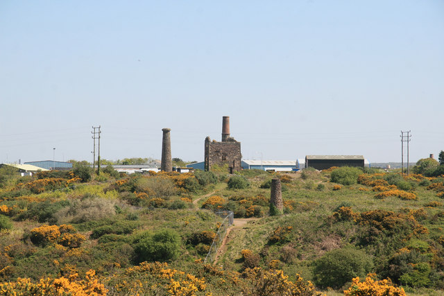
Image: © Chris Allen Taken: 28 Apr 2011
There are two engine houses that served Chappel's Shaft. The visible one is the pumping engine house with a detached stack that has lost its brick upper section. This housed a 50 inch engine in 1838 that was recylinderd to 55 inch in 1872. Behind this is the house for the 26 inch whim dating from about 1860 and this retains a chimney with a brick section. The mine was named after a miner (Cook) who discovered a copper lode as wide as his kitchen. The mine initially mined copper and later tin.
Images are licensed for reuse under creativecommons.org/licenses/by-sa/2.0
Image Location
Latitude
50.219209
Longitude
-5.274741