Newbold-Disused Canal Tunnel
Introduction
The photograph on this page of Newbold-Disused Canal Tunnel by Ian Rob as part of the Geograph project.
The Geograph project started in 2005 with the aim of publishing, organising and preserving representative images for every square kilometre of Great Britain, Ireland and the Isle of Man.

There are currently over 7.5m images from over 14,400 individuals and you can help contribute to the project by visiting https://www.geograph.org.uk
Newbold-Disused Canal Tunnel
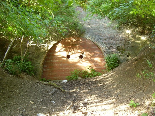
Image: © Ian Rob Taken: 4 May 2011
The tunnel was in use between the 1770s and the 1840s until the canal was realigned through the present day tunnel. This arm of the canal still continued to serve a nearby quarry and brickworks for some time.
Images are licensed for reuse under creativecommons.org/licenses/by-sa/2.0
Image Location


Leaflet Map data © OpenStreetMap
Latitude
52.390222
Longitude
-1.286694