Plaque, corner of Black Road, Macclesfield
Introduction
The photograph on this page of Plaque, corner of Black Road, Macclesfield by Robin Stott as part of the Geograph project.
The Geograph project started in 2005 with the aim of publishing, organising and preserving representative images for every square kilometre of Great Britain, Ireland and the Isle of Man.

There are currently over 7.5m images from over 14,400 individuals and you can help contribute to the project by visiting https://www.geograph.org.uk
Plaque, corner of Black Road, Macclesfield
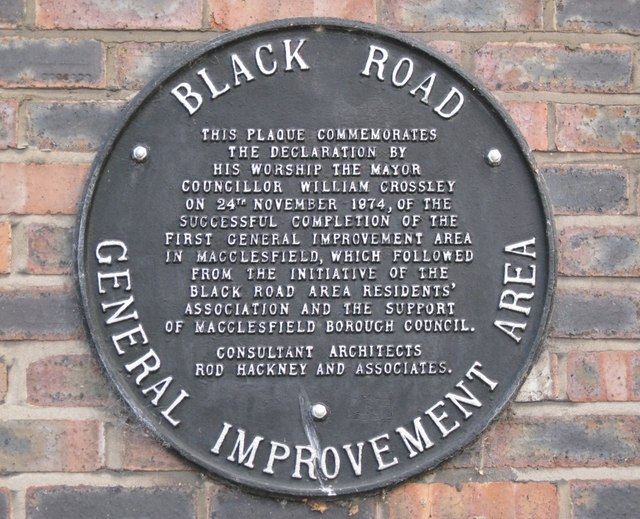
Image: © Robin Stott Taken: 28 Apr 2011
"Black Road General Improvement Area. This plaque commemorates the declaration by His Worship the Mayor Councillor William Crossley on 24th November 1974, of the successful completion of the first General Improvement Area in Macclesfield, which followed from the initiative of the Black Road Area Residents' Association and the support of Macclesfield Borough Council. Consultant Architects Rod Hackney and Associates."
Images are licensed for reuse under creativecommons.org/licenses/by-sa/2.0
Image Location
Latitude
53.252695
Longitude
-2.115518