Construction house Mexborough
Introduction
The photograph on this page of Construction house Mexborough by steve peet as part of the Geograph project.
The Geograph project started in 2005 with the aim of publishing, organising and preserving representative images for every square kilometre of Great Britain, Ireland and the Isle of Man.

There are currently over 7.5m images from over 14,400 individuals and you can help contribute to the project by visiting https://www.geograph.org.uk
Construction house Mexborough
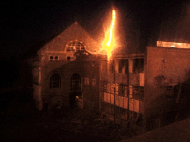
Image: © steve peet Taken: 3 May 2011
This is my 2nd submission of photos taken at 4.00am of the construction house building in Mexborough but taken in a different light. Even though the building is in a dangerous state of dereliction, this one doesn't seem to show it?
Images are licensed for reuse under creativecommons.org/licenses/by-sa/2.0
Image Location
Latitude
53.48989
Longitude
-1.255422