Franklands Village Hall
Introduction
The photograph on this page of Franklands Village Hall by Simon Carey as part of the Geograph project.
The Geograph project started in 2005 with the aim of publishing, organising and preserving representative images for every square kilometre of Great Britain, Ireland and the Isle of Man.

There are currently over 7.5m images from over 14,400 individuals and you can help contribute to the project by visiting https://www.geograph.org.uk
Franklands Village Hall
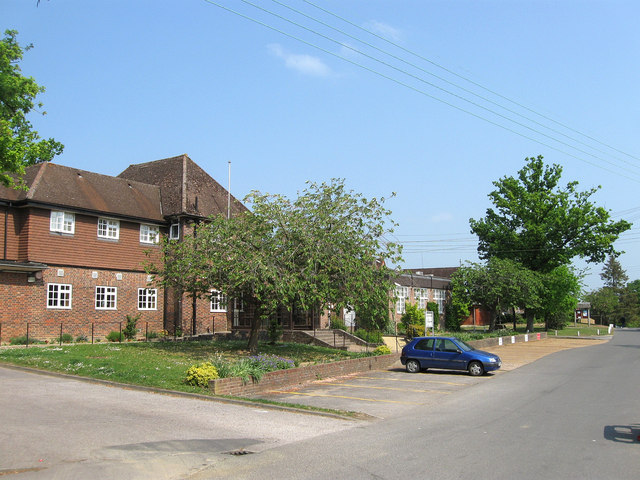
Image: © Simon Carey Taken: 30 Apr 2011
The social hub of the village which includes a social club and facilities for a variety of groups to meet. Beyond is the estate office which is home to the Franklands Village Housing Association. Franklands Village is a model village built in the 1930s in order to create housing for a fair economic rent. Built on the site of Franklands Wood, which was originally part of the parish of Wivelsfield until transferred to Haywards Heath in 1934, the community consists of two roads, Graveleye Lane, on the right, which runs south to north, and Reed Pond Walk, on the left, which loops around in semi circle rejoining Graveleye Lane further up. Facilities include a purpose built shop, a large village hall, a playing field and a church. The Franklands Village Housing Association still let a considerable number of houses today all of which have their own gardens.
Images are licensed for reuse under creativecommons.org/licenses/by-sa/2.0
Image Location


Leaflet Map data © OpenStreetMap
Latitude
50.996463
Longitude
-0.085858