Newton Lodge
Introduction
The photograph on this page of Newton Lodge by Derek Harper as part of the Geograph project.
The Geograph project started in 2005 with the aim of publishing, organising and preserving representative images for every square kilometre of Great Britain, Ireland and the Isle of Man.

There are currently over 7.5m images from over 14,400 individuals and you can help contribute to the project by visiting https://www.geograph.org.uk
Newton Lodge
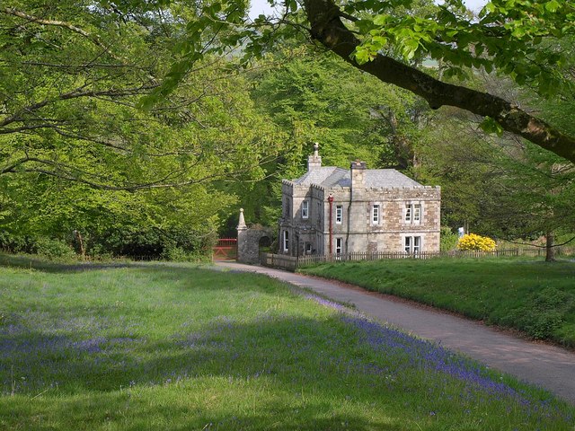
Image: © Derek Harper Taken: 26 Apr 2011
Mapped as Newton Lodge, although the listed building description doesn't acknowledge the name http://www.britishlistedbuildings.co.uk/en-67567-lodge-at-the-east-entrance-to-lanhydrock- . A recent building by the standards of the Lanhydrock estate, being late C19. The gate pier to the left is part of the grade I listed Gateway and Flanking Walls, dating from 1657 http://www.britishlistedbuildings.co.uk/en-67568-gateway-and-flanking-walls-at-the-east-en .
Images are licensed for reuse under creativecommons.org/licenses/by-sa/2.0
Image Location


Leaflet Map data © OpenStreetMap
Latitude
50.440353
Longitude
-4.684169