Hurst House
Introduction
The photograph on this page of Hurst House by Simon Carey as part of the Geograph project.
The Geograph project started in 2005 with the aim of publishing, organising and preserving representative images for every square kilometre of Great Britain, Ireland and the Isle of Man.

There are currently over 7.5m images from over 14,400 individuals and you can help contribute to the project by visiting https://www.geograph.org.uk
Hurst House
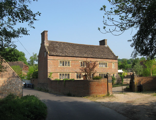
Image: © Simon Carey Taken: 30 Apr 2011
Former farmhouse that dates back to the 17th century. The original family called Hurst set up the farm in the medieval period and had become successful brickmakers by the 16th century building this house with the both their technical expertise and money they had made from that trade. Known as Hursthouse Farm until the 1860s when land to the north was sold to facilitate the construction of the Sussex County Lunatic Asylum. The farm was renamed Asylum Farm when acquired by it in order to provide provisions and employment for the patients in keeping with the Victorian ideal of self sufficiency. When the asylum became a mental hospital in 1919 the farm also changed its name to Hospital Farm and continued being part of the hospital until a new law was passed in 1970 forbidding patients from any employment within the hospital. The farmhouse and outbuildings were sold off in 1978 with the latter becoming a business park, Image, with the farmhouse eventually reverting to its original name having become a private residence. Viewed from the access road to Hurstwood Grange.
Images are licensed for reuse under creativecommons.org/licenses/by-sa/2.0
Image Location
Latitude
50.986588
Longitude
-0.092391