Alfreton Road: no longer a crossroads
Introduction
The photograph on this page of Alfreton Road: no longer a crossroads by John Sutton as part of the Geograph project.
The Geograph project started in 2005 with the aim of publishing, organising and preserving representative images for every square kilometre of Great Britain, Ireland and the Isle of Man.

There are currently over 7.5m images from over 14,400 individuals and you can help contribute to the project by visiting https://www.geograph.org.uk
Alfreton Road: no longer a crossroads
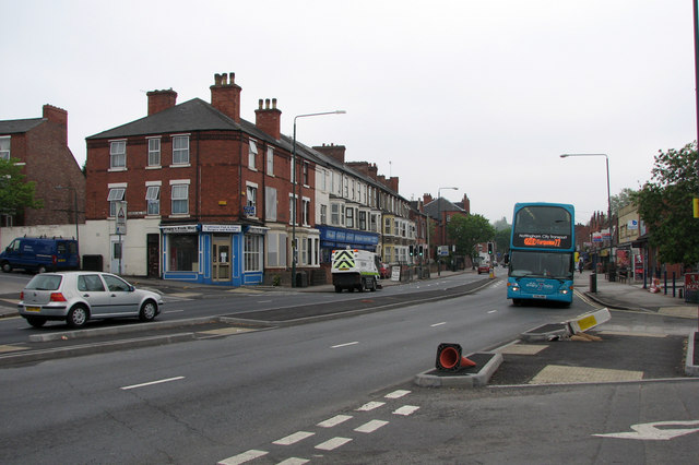
Image: © John Sutton Taken: 29 Apr 2011
The road layout is being altered to prevent traffic from Bobbers Mill Road (on the left) and Churchfield Lane (to the right) crossing Alfreton Road. A No 77 bus is on its way to Strelley Estate. The left side of Alfreton Road is a typical Nottingham three-storey terrace of the 1880s; the other side was developed in the late 1930s.
Images are licensed for reuse under creativecommons.org/licenses/by-sa/2.0
Image Location
Latitude
52.964342
Longitude
-1.179615