Cavendish House and Park East, Southdowns Park
Introduction
The photograph on this page of Cavendish House and Park East, Southdowns Park by Simon Carey as part of the Geograph project.
The Geograph project started in 2005 with the aim of publishing, organising and preserving representative images for every square kilometre of Great Britain, Ireland and the Isle of Man.

There are currently over 7.5m images from over 14,400 individuals and you can help contribute to the project by visiting https://www.geograph.org.uk
Cavendish House and Park East, Southdowns Park
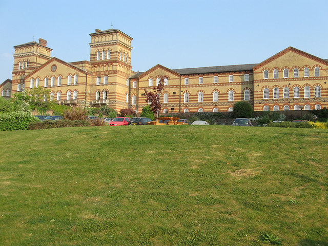
Image: © Simon Carey Taken: 30 Apr 2011
Cavendish House to the left between the two towers was once the administrative centre of the former asylum and was flanked by the male wards to the east, now Park East, and the female wards to the west, now Park West which is out of shot. Both have now been converted to residential use.
Images are licensed for reuse under creativecommons.org/licenses/by-sa/2.0
Image Location
Latitude
50.989441
Longitude
-0.096406