The Royal William, Faversham
Introduction
The photograph on this page of The Royal William, Faversham by David Anstiss as part of the Geograph project.
The Geograph project started in 2005 with the aim of publishing, organising and preserving representative images for every square kilometre of Great Britain, Ireland and the Isle of Man.

There are currently over 7.5m images from over 14,400 individuals and you can help contribute to the project by visiting https://www.geograph.org.uk
The Royal William, Faversham
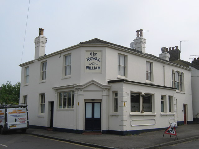
Image: © David Anstiss Taken: 29 Apr 2011
Closed public house, now a private house, (closed in the late 1990s / early 2000s) on the junction of William Street (on the left) and St.Mary's Road (on the right). See also http://deadpubs.co.uk/KentPubs/Faversham/RoyalWilliam.shtml
Images are licensed for reuse under creativecommons.org/licenses/by-sa/2.0
Image Location
Latitude
51.312878
Longitude
0.893343