Lostwithiel: Restormel Royal Mine
Introduction
The photograph on this page of Lostwithiel: Restormel Royal Mine by Martin Bodman as part of the Geograph project.
The Geograph project started in 2005 with the aim of publishing, organising and preserving representative images for every square kilometre of Great Britain, Ireland and the Isle of Man.

There are currently over 7.5m images from over 14,400 individuals and you can help contribute to the project by visiting https://www.geograph.org.uk
Lostwithiel: Restormel Royal Mine
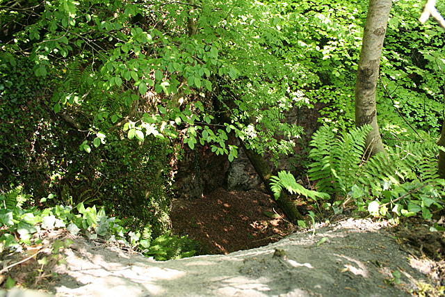
Image: © Martin Bodman Taken: 27 Apr 2011
Looking down into a deep cutting by the probable entrance to the deep adit of the iron mine, which had its most productive period in the nineteenth century. It was visited by Queen Victoria in the 1840s, hence the 'Royal' appellation
Images are licensed for reuse under creativecommons.org/licenses/by-sa/2.0
Image Location
Latitude
50.416402
Longitude
-4.677465