Craig
Introduction
The photograph on this page of Craig by Richard Dorrell as part of the Geograph project.
The Geograph project started in 2005 with the aim of publishing, organising and preserving representative images for every square kilometre of Great Britain, Ireland and the Isle of Man.

There are currently over 7.5m images from over 14,400 individuals and you can help contribute to the project by visiting https://www.geograph.org.uk
Craig
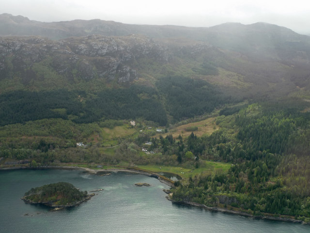
Image: © Richard Dorrell Taken: 23 Apr 2011
An aerial view. There are just a few buildings in Craig, which lies under the steep misty slope of Carn a Bhealaich Mòr. The railway to Kyle of Lochalsh can just be seen running along the shore. The wooded island is Eilean na Creige Duibhe.
Images are licensed for reuse under creativecommons.org/licenses/by-sa/2.0
Image Location
Latitude
57.337768
Longitude
-5.620198