Saxon Shore Way and National Cycle Network 1 near Deal Castle
Introduction
The photograph on this page of Saxon Shore Way and National Cycle Network 1 near Deal Castle by David Anstiss as part of the Geograph project.
The Geograph project started in 2005 with the aim of publishing, organising and preserving representative images for every square kilometre of Great Britain, Ireland and the Isle of Man.

There are currently over 7.5m images from over 14,400 individuals and you can help contribute to the project by visiting https://www.geograph.org.uk
Saxon Shore Way and National Cycle Network 1 near Deal Castle
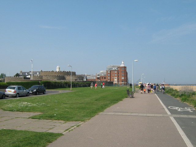
Image: © David Anstiss Taken: 24 Apr 2011
The long distance path (on the left) leads beside the cyclepath (on the right) towards Deal. It leads beside the shingle beach between Kingsdown and Walmer. Deal Castle is on the left.
Images are licensed for reuse under creativecommons.org/licenses/by-sa/2.0
Image Location
Latitude
51.218089
Longitude
1.404011