Edgwarebury Lane
Introduction
The photograph on this page of Edgwarebury Lane by Martin Addison as part of the Geograph project.
The Geograph project started in 2005 with the aim of publishing, organising and preserving representative images for every square kilometre of Great Britain, Ireland and the Isle of Man.

There are currently over 7.5m images from over 14,400 individuals and you can help contribute to the project by visiting https://www.geograph.org.uk
Edgwarebury Lane
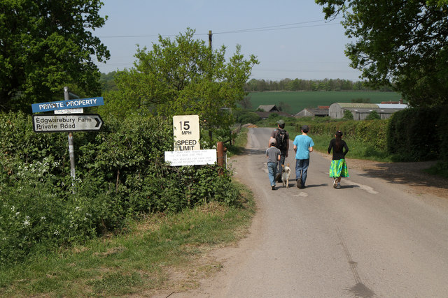
Image: © Martin Addison Taken: 21 Apr 2011
A plethora of signs - one highways agency, the others not, advertise that this is a private road. The white sign below the 15mph sign reads 'Bury Farm private road - This is a dead end road - Only vehicles for farm shop - stables and residents drive slowly'. There's also a no parking sign hiding below the blue private property sign. The road is a restricted byway and the party going the other way seem to be having a good time - especially the young lady who looks to be breaking into a dance routine :-)
Images are licensed for reuse under creativecommons.org/licenses/by-sa/2.0
Image Location
Latitude
51.631837
Longitude
-0.280697