Wyvern Marina
Introduction
The photograph on this page of Wyvern Marina by David Lally as part of the Geograph project.
The Geograph project started in 2005 with the aim of publishing, organising and preserving representative images for every square kilometre of Great Britain, Ireland and the Isle of Man.

There are currently over 7.5m images from over 14,400 individuals and you can help contribute to the project by visiting https://www.geograph.org.uk
Wyvern Marina
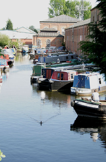
Image: © David Lally Taken: 25 Apr 2011
As far as I was aware until reading an information board close to where this was taken from this was still called the Sheet Stores Basin, but apparently not. The board also enlightened me as to where the curious name of "Sheet Stores" came from: The origin of this group of industrial buildings was as a coal wharf for the Midland Counties Railways in 1840, as the need for canal-transported coal declined this became the Midland Railways Sheet Stores, where tarpaulins were made and repaired. That use finished in 1963 and the area is now a general industrial estate. A boatyard serves the boats, the sound of an angle grinder filled the air at the time that this was taken.
Images are licensed for reuse under creativecommons.org/licenses/by-sa/2.0
Image Location
Latitude
52.884086
Longitude
-1.27847