River Irwell, Chapel Wharf
Introduction
The photograph on this page of River Irwell, Chapel Wharf by David Dixon as part of the Geograph project.
The Geograph project started in 2005 with the aim of publishing, organising and preserving representative images for every square kilometre of Great Britain, Ireland and the Isle of Man.

There are currently over 7.5m images from over 14,400 individuals and you can help contribute to the project by visiting https://www.geograph.org.uk
River Irwell, Chapel Wharf
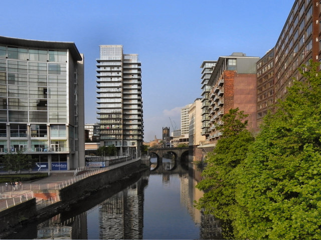
Image: © David Dixon Taken: 22 Apr 2011
Looking upstream from Image Ahead is Blackfriars Bridge and in the distance, Image To the left, is the newly regenerated Chapel Wharf area of Salford with its piazza and riverside walks. On right (the Manchester side of the river) the buildings are mainly 1960s office blocks backing directly on to the river although a couple have been converted into apartments complete with balconies overlooking the river.
Images are licensed for reuse under creativecommons.org/licenses/by-sa/2.0
Image Location
Latitude
53.4835
Longitude
-2.248303