Council offices, past and present
Introduction
The photograph on this page of Council offices, past and present by Rose and Trev Clough as part of the Geograph project.
The Geograph project started in 2005 with the aim of publishing, organising and preserving representative images for every square kilometre of Great Britain, Ireland and the Isle of Man.

There are currently over 7.5m images from over 14,400 individuals and you can help contribute to the project by visiting https://www.geograph.org.uk
Council offices, past and present
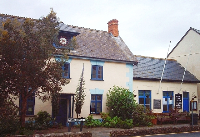
Image: © Rose and Trev Clough Taken: 13 May 2007
The taller building (late 18th century http://www.imagesofengland.org.uk/details/default.aspx?id=264625 ) was used for some time as a local government office, now once again a private house. Instead of numbers around the clock face there is an inscription, which says "Elizabeth II". Watchet Conservation Society has old photos and information about this house http://www.watchetconservationsociety.co.uk/building_courthouse.html . The lower building (c.1860) is the current Watchet Town Council chambers and offices. For a closer view of the unusual spiky plant, see Image .
Images are licensed for reuse under creativecommons.org/licenses/by-sa/2.0
Image Location


Leaflet Map data © OpenStreetMap
Latitude
51.180909
Longitude
-3.330335