Inverkeithing Parish Kirk
Introduction
The photograph on this page of Inverkeithing Parish Kirk by kim traynor as part of the Geograph project.
The Geograph project started in 2005 with the aim of publishing, organising and preserving representative images for every square kilometre of Great Britain, Ireland and the Isle of Man.

There are currently over 7.5m images from over 14,400 individuals and you can help contribute to the project by visiting https://www.geograph.org.uk
Inverkeithing Parish Kirk
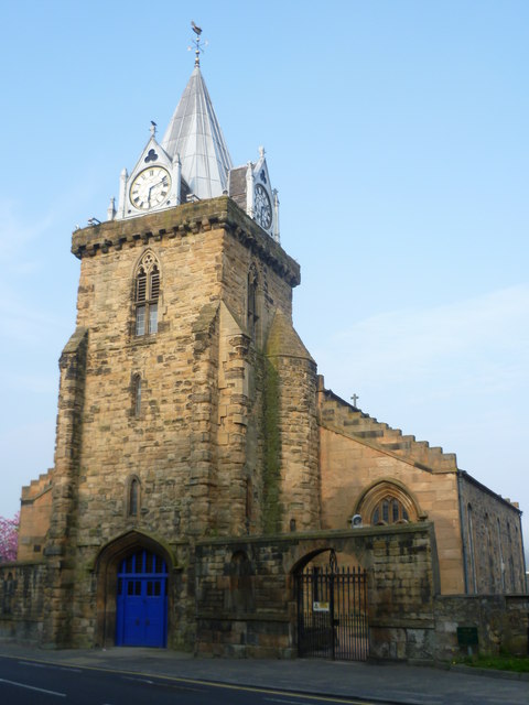
Image: © kim traynor Taken: 20 Apr 2011
The western tower of St. Peter's is the oldest part of the kirk, dating from the 14th century. The main part of the building is a neo-Gothic rebuild following a devastating fire in the 1820s.
Images are licensed for reuse under creativecommons.org/licenses/by-sa/2.0
Image Location
Latitude
56.031695
Longitude
-3.397524