St. Andrew's - Revisited
Introduction
The photograph on this page of St. Andrew's - Revisited by John Myers as part of the Geograph project.
The Geograph project started in 2005 with the aim of publishing, organising and preserving representative images for every square kilometre of Great Britain, Ireland and the Isle of Man.

There are currently over 7.5m images from over 14,400 individuals and you can help contribute to the project by visiting https://www.geograph.org.uk
St. Andrew's - Revisited
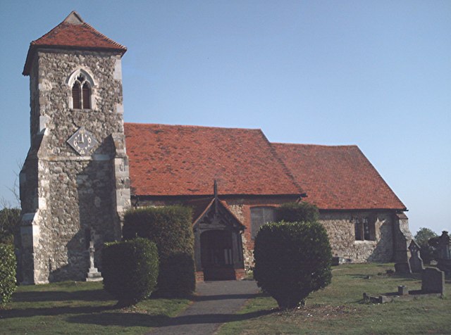
Image: © John Myers Taken: 10 Sep 2006
Landmark church on the Roach Valley Way, St.Andrew's, Ashingdon following restoration work Image On the marshlands which then lay below the hill upon which the church stands, was fought the legendary battle of Assandune (AD 1016), where the Danish king Cnut defeated the then "King of England", Edmund Ironside and went on to fail to hold back the tide. Cnut is said to have financed the construction of St. Andrews in 1020 in thanks for his victory.
Images are licensed for reuse under creativecommons.org/licenses/by-sa/2.0
Image Location
Latitude
51.610337
Longitude
0.692086