Old quarry near Menheniot
Introduction
The photograph on this page of Old quarry near Menheniot by David Lally as part of the Geograph project.
The Geograph project started in 2005 with the aim of publishing, organising and preserving representative images for every square kilometre of Great Britain, Ireland and the Isle of Man.

There are currently over 7.5m images from over 14,400 individuals and you can help contribute to the project by visiting https://www.geograph.org.uk
Old quarry near Menheniot
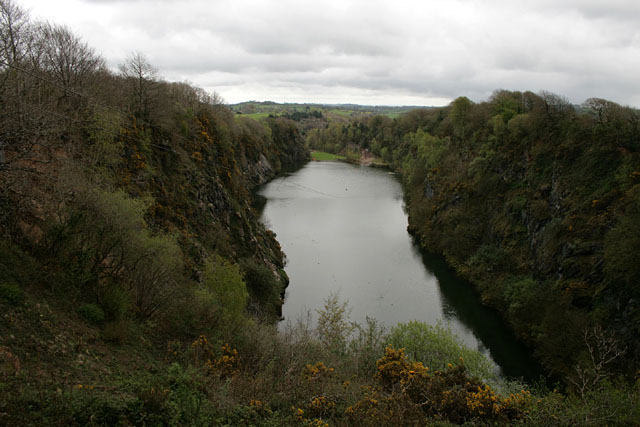
Image: © David Lally Taken: 14 Apr 2011
I if you look very carefully you will make out a zip wire which runs from here to the opposite end of the flooded quarry (at the patch of earth visible just to the right of centre). The dot which can be seen towards the top centre of the water is one of the two current riders. It is promoted as the "Highest, longest and fastest zip wire" currently operating in the UK.
Images are licensed for reuse under creativecommons.org/licenses/by-sa/2.0
Image Location
Latitude
50.427021
Longitude
-4.416895