Camp House
Introduction
The photograph on this page of Camp House by Michael Dibb as part of the Geograph project.
The Geograph project started in 2005 with the aim of publishing, organising and preserving representative images for every square kilometre of Great Britain, Ireland and the Isle of Man.

There are currently over 7.5m images from over 14,400 individuals and you can help contribute to the project by visiting https://www.geograph.org.uk
Camp House
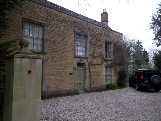
Image: © Michael Dibb Taken: 2 Apr 2011
The front of this house, listed Grade II, is delightful. The house is late 18th century with some older work in the rear wing.
Images are licensed for reuse under creativecommons.org/licenses/by-sa/2.0
Image Location
Latitude
51.88649
Longitude
-1.75339