Ballycowan Triangulation Pillar
Introduction
The photograph on this page of Ballycowan Triangulation Pillar by Rossographer as part of the Geograph project.
The Geograph project started in 2005 with the aim of publishing, organising and preserving representative images for every square kilometre of Great Britain, Ireland and the Isle of Man.

There are currently over 7.5m images from over 14,400 individuals and you can help contribute to the project by visiting https://www.geograph.org.uk
Ballycowan Triangulation Pillar
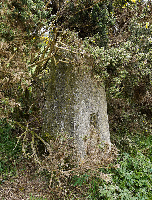
Image: © Rossographer Taken: 18 Apr 2011
Trig pillar located in a field in Ballycowan Townland. Access is via a farm track and field from the Ballycoan Road, south east from Ballylesson or west from Carryduff. The pillar lies partially hidden by whins and is in good condition although slightly grubby. The views have been obscured by the whins to all directions except south; on a clear day the pillar offers good views over south Belfast towards Divis and Black Mountain in the west. See also Image and Image
Images are licensed for reuse under creativecommons.org/licenses/by-sa/2.0
Image Location
Latitude
54.526089
Longitude
-5.931208