Once a railway
Introduction
The photograph on this page of Once a railway by John Sutton as part of the Geograph project.
The Geograph project started in 2005 with the aim of publishing, organising and preserving representative images for every square kilometre of Great Britain, Ireland and the Isle of Man.

There are currently over 7.5m images from over 14,400 individuals and you can help contribute to the project by visiting https://www.geograph.org.uk
Once a railway
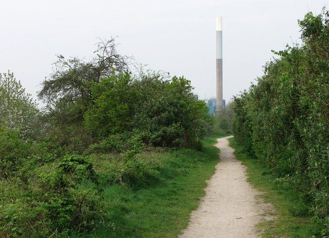
Image: © John Sutton Taken: 15 Apr 2011
This was, until the 1960s, the route built by the Ambergate, Nottingham, Boston & Eastern Junction (later the Great Northern) Railway in the 1850s, leading to its London Road terminus and, after 1900, via London Road High Level, to Nottingham Victoria. Trains to and from Grantham and holiday specials carrying Nottinghamians to the East Coast used this line. The chimney of Eastcroft Incinerator is straight ahead, on the other side of the remaining railway, the Midland route to Newark and Lincoln (which has been used by Grantham trains, which branch off at Netherfield, since Victoria Station closed).
Images are licensed for reuse under creativecommons.org/licenses/by-sa/2.0
Image Location
Latitude
52.947959
Longitude
-1.126049