Bank erosion River Bollin
Introduction
The photograph on this page of Bank erosion River Bollin by Peter Turner as part of the Geograph project.
The Geograph project started in 2005 with the aim of publishing, organising and preserving representative images for every square kilometre of Great Britain, Ireland and the Isle of Man.

There are currently over 7.5m images from over 14,400 individuals and you can help contribute to the project by visiting https://www.geograph.org.uk
Bank erosion River Bollin
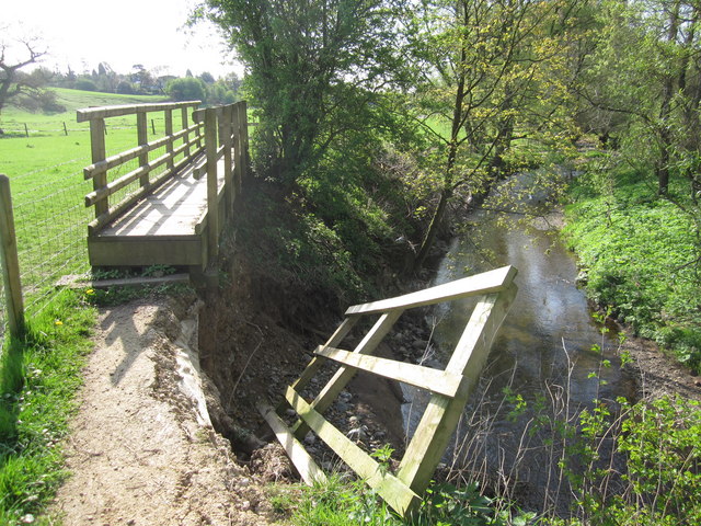
Image: © Peter Turner Taken: 17 Apr 2011
The winter's heavy rains have done damage to the banks of the Bollin all along this stretch. A vulnerable section of bank here, hence the 'bridge structure' over the worst affected part, has been seriously undermined by water action. Closed to pedestrians, the footpath is diverted into the field.
Images are licensed for reuse under creativecommons.org/licenses/by-sa/2.0
Image Location
Latitude
53.297235
Longitude
-2.154798