High Street from the Clock Tower
Introduction
The photograph on this page of High Street from the Clock Tower by Hugh Craddock as part of the Geograph project.
The Geograph project started in 2005 with the aim of publishing, organising and preserving representative images for every square kilometre of Great Britain, Ireland and the Isle of Man.

There are currently over 7.5m images from over 14,400 individuals and you can help contribute to the project by visiting https://www.geograph.org.uk
High Street from the Clock Tower
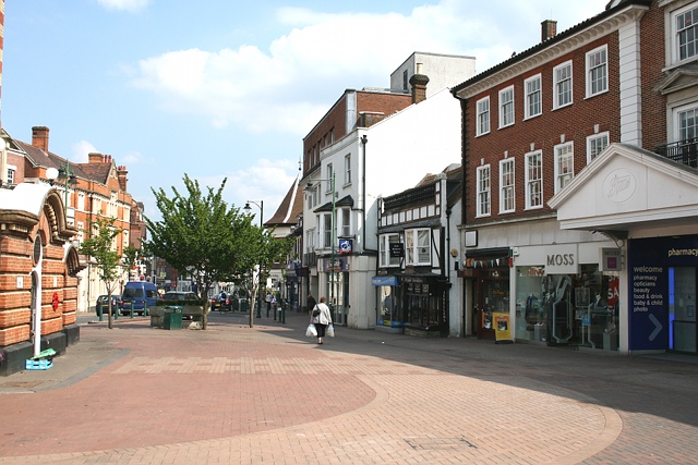
Image: © Hugh Craddock Taken: 17 Apr 2011
Looking east along the High Street, with the base of the Clock Tower visible on the left, and the entrance to Boots on the right. Just ahead, below the tree, is a drinking trough provided by the Metropolitan Drinking Fountain and Cattle Trough Association. The white sided building on the right, projecting slightly (and now the Nationwide Building Society), and to its right, the much smaller Nell Gwynne House, are the only historic buildings on the right hand side of the High Street visible here and in this Francis Frith photo dating from 1924: http://www.francisfrith.com/epsom/photos/high-street-1924_75371a/ and http://www.geograph.org.uk/stuff/frith.php?id=2361498 . On the left side of the road can be seen a three-storey building which now houses (among others) the post office. There is now no sign of the King's Head, which was on the site now occupied by Boots.
Images are licensed for reuse under creativecommons.org/licenses/by-sa/2.0
Image Location
Latitude
51.333037
Longitude
-0.268398