On Dodge Hill
Introduction
The photograph on this page of On Dodge Hill by Gerald England as part of the Geograph project.
The Geograph project started in 2005 with the aim of publishing, organising and preserving representative images for every square kilometre of Great Britain, Ireland and the Isle of Man.

There are currently over 7.5m images from over 14,400 individuals and you can help contribute to the project by visiting https://www.geograph.org.uk
On Dodge Hill
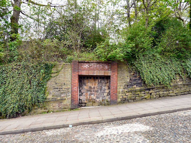
Image: © Gerald England Taken: 14 Apr 2011
I first thought that this was an old air-raid shelter. There certainly is an old air-raid shelter on Dodge Hill but according to an archived document http://web.archive.org/web/20150624115924/http://www.stockport.gov.uk:80/2013/2978/8803/9020/12299/dodgehillapp1 (see page 4), this was a man-made cavern used until the early part of the 19th century as a smithy.
Images are licensed for reuse under creativecommons.org/licenses/by-sa/2.0
Image Location
Latitude
53.414438
Longitude
-2.160941