Afon Tywi north of Rhandirmwyn, Carmarthenshire
Introduction
The photograph on this page of Afon Tywi north of Rhandirmwyn, Carmarthenshire by Roger D Kidd as part of the Geograph project.
The Geograph project started in 2005 with the aim of publishing, organising and preserving representative images for every square kilometre of Great Britain, Ireland and the Isle of Man.

There are currently over 7.5m images from over 14,400 individuals and you can help contribute to the project by visiting https://www.geograph.org.uk
Afon Tywi north of Rhandirmwyn, Carmarthenshire
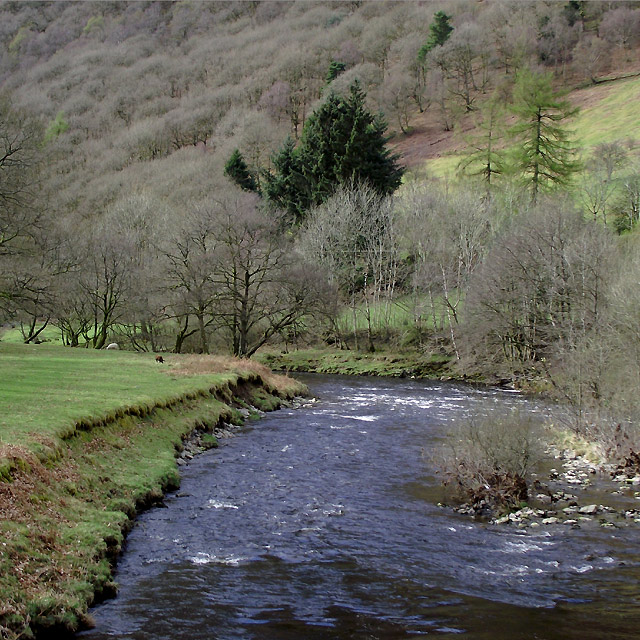
Image: © Roger D Kidd Taken: 2 Apr 2011
Looking east from the bridge by Gallt-y-bere farm, downstream towards Rhandirmwyn. Information from The Carmarthenshire Rivers Trust www.carmarthenshire.org: The source of the 75 mile long Afon Tywi lies in the Cambrian Mountains of Mid Wales, within 15 miles of the sources of the Severn and Wye, and the smaller Cardigan Bay rivers Teifi, Rheidol and Ystwyth. The upper catchment comprises afforested undulating moorland. The Tywi Fach rises at an elevation of some 1400 feet above sea level, while the Tywi Fechan rises nearby at 1600 feet. Just 6 miles downstream, the river flows into the 4 mile long Eastern arm of Llyn Brianne reservoir, while the Afon Camddwr flows into the 3 mile Western arm. A continual release of water from the flow-regulating reservoir marks the start of the main river. The Towy falls quite steeply for 10 miles before flowing out onto the flood plain near Llandovery. The river then meanders its way along and across the 1 mile wide, virtually flat plain for 30 miles down to Carmarthen and the 12 mile long estuary. With numerous tributaries, the average river flow increases from 157 million gallons per day (mgd) at Llandovery, to 400 mgd at Llandeilo and 855 mgd at Carmarthen (total catchment 515 sq. miles). The main tributary is the 33 mile long Cothi. With a catchment of 116 sq. miles, the Cothi has an average flow of 120 mgd at its confluence with the Towy. Other significant tributaries include the 7 mile Doethie (20 sq. miles, 35 mgd); 13 mile Bran (50 sq. miles, 71 mgd); 10 mile Sawdde (32 sq. miles, 70 mgd), and 16 mile Gwili (57 sq. miles, 95 mgd).
Images are licensed for reuse under creativecommons.org/licenses/by-sa/2.0
Image Location
Latitude
52.098627
Longitude
-3.793897