Former RAF Upper Heyford from the air
Introduction
The photograph on this page of Former RAF Upper Heyford from the air by Thomas Nugent as part of the Geograph project.
The Geograph project started in 2005 with the aim of publishing, organising and preserving representative images for every square kilometre of Great Britain, Ireland and the Isle of Man.

There are currently over 7.5m images from over 14,400 individuals and you can help contribute to the project by visiting https://www.geograph.org.uk
Former RAF Upper Heyford from the air
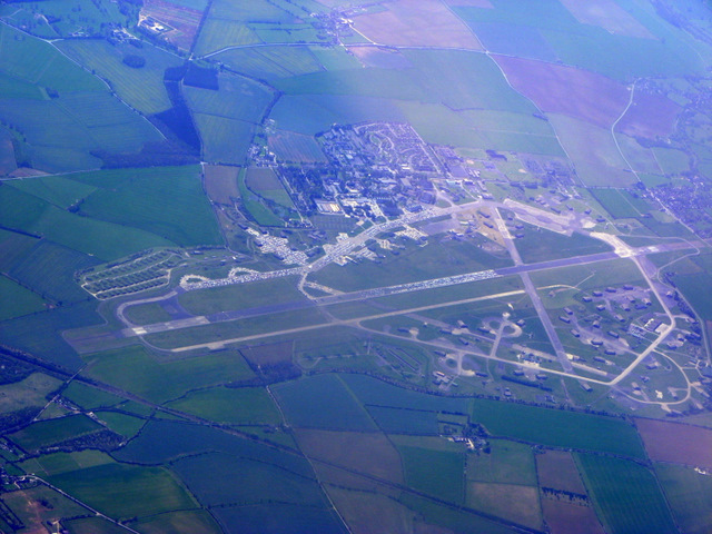
Image: © Thomas Nugent Taken: 10 Apr 2011
The base closed in 1993. Here is a http://en.wikipedia.org/wiki/RAF_Upper_Heyford#Cold_War_Use_By_USAF to the wikipedia article about the base which is now used for storing vehicles. Viewed from a Heathrow bound flight from Glasgow. See also Image See Image which was taken in July 2015.
Images are licensed for reuse under creativecommons.org/licenses/by-sa/2.0
Image Location


Leaflet Map data © OpenStreetMap
Latitude
51.943531
Longitude
-1.237643