Moor Lane Bridge, Grand Union Canal
Introduction
The photograph on this page of Moor Lane Bridge, Grand Union Canal by Stephen McKay as part of the Geograph project.
The Geograph project started in 2005 with the aim of publishing, organising and preserving representative images for every square kilometre of Great Britain, Ireland and the Isle of Man.

There are currently over 7.5m images from over 14,400 individuals and you can help contribute to the project by visiting https://www.geograph.org.uk
Moor Lane Bridge, Grand Union Canal
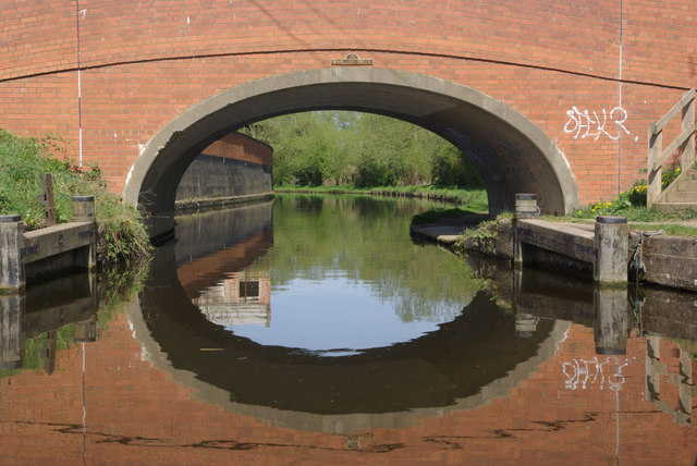
Image: © Stephen McKay Taken: 10 Apr 2011
The brilliant spring sunshine gives a shimmering reflection of the bridge in the water. Between Leicester and the River Trent the Grand Union Canal interweaves with the River Soar and is really a river navigation, but the stretch through Loughborough is a canal, the river passing to the north east of the town.
Images are licensed for reuse under creativecommons.org/licenses/by-sa/2.0
Image Location


Leaflet Map data © OpenStreetMap
Latitude
52.768541
Longitude
-1.191748