The Lund
Introduction
The photograph on this page of The Lund by Pauline E as part of the Geograph project.
The Geograph project started in 2005 with the aim of publishing, organising and preserving representative images for every square kilometre of Great Britain, Ireland and the Isle of Man.

There are currently over 7.5m images from over 14,400 individuals and you can help contribute to the project by visiting https://www.geograph.org.uk
The Lund
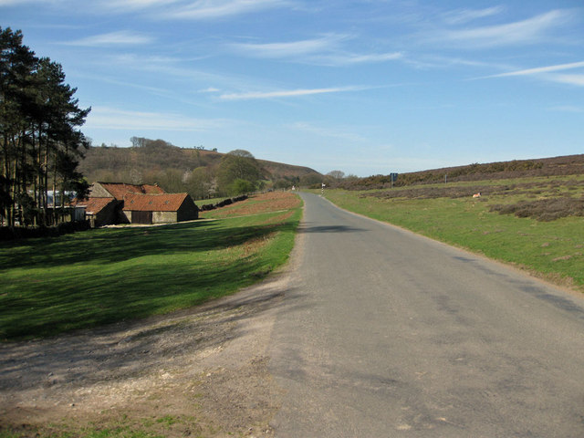
Image: © Pauline E Taken: 10 Apr 2011
On the southern edge of Spaunton Moor. View towards Shepherd's Nab. Lund is an old Norse word meaning 'Grove of trees'. The present farmhouse was built in 1960 on the foundations of the previous building. The farm has a long association with sheep farming.
Images are licensed for reuse under creativecommons.org/licenses/by-sa/2.0
Image Location
Latitude
54.304223
Longitude
-0.914081