Plaque on a wall in Thoresby Street
Introduction
The photograph on this page of Plaque on a wall in Thoresby Street by Robert Lamb as part of the Geograph project.
The Geograph project started in 2005 with the aim of publishing, organising and preserving representative images for every square kilometre of Great Britain, Ireland and the Isle of Man.

There are currently over 7.5m images from over 14,400 individuals and you can help contribute to the project by visiting https://www.geograph.org.uk
Plaque on a wall in Thoresby Street
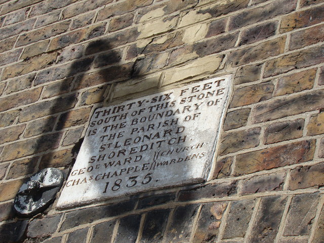
Image: © Robert Lamb Taken: 10 Apr 2011
This plaque marks the boundary between two Shoreditch parishes and dates back to 1835. I wish the lamp post which is casting a shadow over the plaque could have been moved further along the street - it is really spoiling the shot in my opinion! Looking north-northwest.
Images are licensed for reuse under creativecommons.org/licenses/by-sa/2.0
Image Location
Latitude
51.530244
Longitude
-0.09455