Holy Cross, Hoggeston
Introduction
The photograph on this page of Holy Cross, Hoggeston by Rob Farrow as part of the Geograph project.
The Geograph project started in 2005 with the aim of publishing, organising and preserving representative images for every square kilometre of Great Britain, Ireland and the Isle of Man.

There are currently over 7.5m images from over 14,400 individuals and you can help contribute to the project by visiting https://www.geograph.org.uk
Holy Cross, Hoggeston
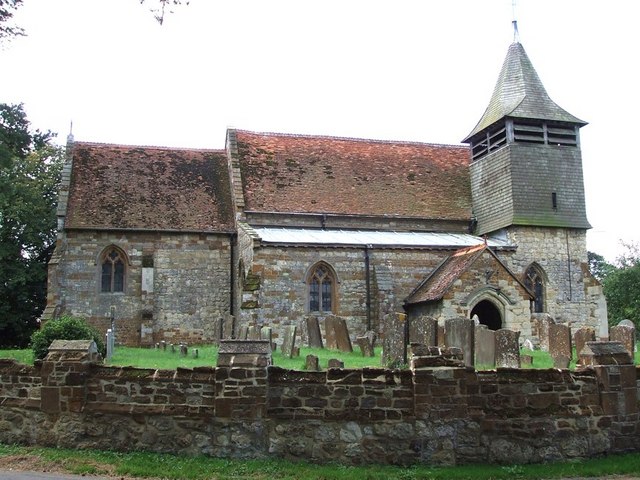
Image: © Rob Farrow Taken: 7 Sep 2006
Hoggeston's little church dates originally, like nearby Dunton's church, from the C12th. I'm a little surprised that the OS map shows this as a "church with a tower" especially if you compare it with Image] I originally entitled this image "SS Peter & Paul" as according to this http://www.british-history.ac.uk/report.asp?compid=42581#s3 that is the dedication of the church, but the church's own website here http://www.schorneteam.co.uk/hoggeston/index.php disabuses me of this, hence the correction to the title.
Images are licensed for reuse under creativecommons.org/licenses/by-sa/2.0
Image Location
Latitude
51.917674
Longitude
-0.826601