Benchmark and curious other marks
Introduction
The photograph on this page of Benchmark and curious other marks by Neil Owen as part of the Geograph project.
The Geograph project started in 2005 with the aim of publishing, organising and preserving representative images for every square kilometre of Great Britain, Ireland and the Isle of Man.

There are currently over 7.5m images from over 14,400 individuals and you can help contribute to the project by visiting https://www.geograph.org.uk
Benchmark and curious other marks
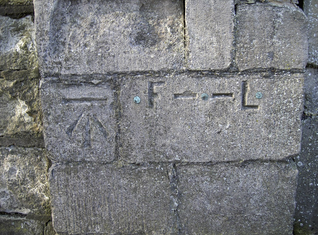
Image: © Neil Owen Taken: 8 Apr 2011
Located on the wall at the end of the cemetery on the Lower Bristol Road, this typical cut benchmark appears to have some companions. It is listed in the Benchmark Database http://www.bench-marks.org.uk/bm37547 and also in the OS database http://benchmarks.ordnancesurvey.co.uk/pls/htmldb/f?p=111:3:240612126947769839:pg_R_2926232049911008:NO&pg_min_row=31&pg_max_rows=15&pg_rows_fetched=15, but the other marks have no reference. However, it appears likely to be a flood level mark - one of several around the area. The Avon is not far away and has overflowed many times in the past. Compare them to Image], a short distance away.
Images are licensed for reuse under creativecommons.org/licenses/by-sa/2.0
Image Location
Latitude
51.380663
Longitude
-2.373537