Lound Hall
Introduction
The photograph on this page of Lound Hall by Alan Murray-Rust as part of the Geograph project.
The Geograph project started in 2005 with the aim of publishing, organising and preserving representative images for every square kilometre of Great Britain, Ireland and the Isle of Man.

There are currently over 7.5m images from over 14,400 individuals and you can help contribute to the project by visiting https://www.geograph.org.uk
Lound Hall
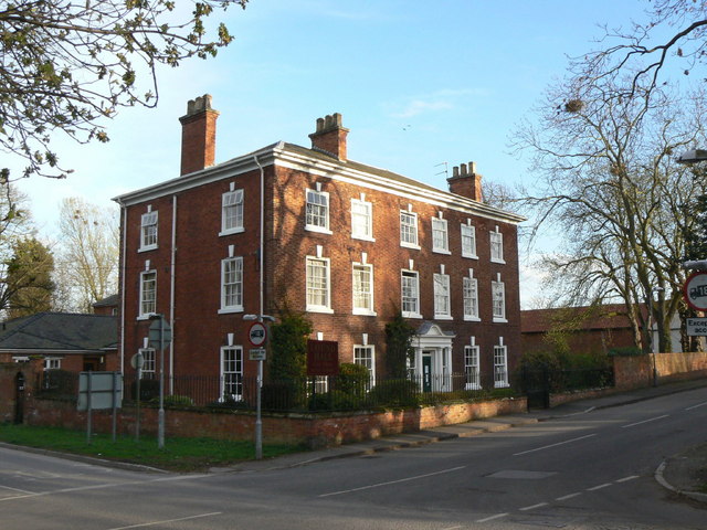
Image: © Alan Murray-Rust Taken: 31 Mar 2011
Imposing Grade II Listed house in the centre of the village, dating from the mid 18th century. Now a residential care home.
Images are licensed for reuse under creativecommons.org/licenses/by-sa/2.0
Image Location
Latitude
53.365987
Longitude
-0.961375