Kirkheaton Manor House
Introduction
The photograph on this page of Kirkheaton Manor House by Les Hull as part of the Geograph project.
The Geograph project started in 2005 with the aim of publishing, organising and preserving representative images for every square kilometre of Great Britain, Ireland and the Isle of Man.

There are currently over 7.5m images from over 14,400 individuals and you can help contribute to the project by visiting https://www.geograph.org.uk
Kirkheaton Manor House
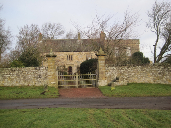
Image: © Les Hull Taken: 19 Jan 2011
This house incorporates a 16th century bastle and has later additions dating to the 17th, 18th and 20th centuries. It was probably built for Cuthbert Heron of Kirkheaton at the end of the 16th century and was lived in until 1900. For the next 30 years it lay empty and became derelict, but was restored by 1931. The north wall and end walls of the main part of the building have walls about 1m wide and are probably the remains of the original defensible building or bastle. There may also have been a turret or possibly a full size tower. In the 17th century the building was altered and many features of this period still survive. An extension was built in the mid-18th century as well as some alterations to the main building. The 20th century restoration heightened many of the rooms in the main building and enlarged the windows. This is a Grade II* Listed Building protected by law. http://www.keystothepast.info/durhamcc/K2P.nsf/K2PDetail?readform&PRN=N10188
Images are licensed for reuse under creativecommons.org/licenses/by-sa/2.0
Image Location
Latitude
55.090491
Longitude
-1.971769