Cruwys Morchard: Nomansland Congregational Church
Introduction
The photograph on this page of Cruwys Morchard: Nomansland Congregational Church by Martin Bodman as part of the Geograph project.
The Geograph project started in 2005 with the aim of publishing, organising and preserving representative images for every square kilometre of Great Britain, Ireland and the Isle of Man.

There are currently over 7.5m images from over 14,400 individuals and you can help contribute to the project by visiting https://www.geograph.org.uk
Cruwys Morchard: Nomansland Congregational Church
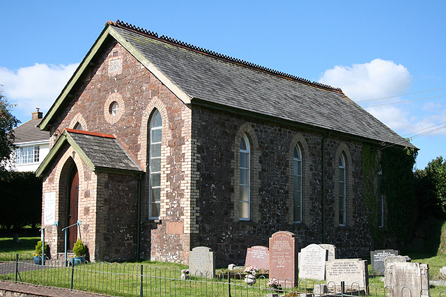
Image: © Martin Bodman Taken: 7 Sep 2006
The chapel stands at the eastern end of Nomansland, a hamlet by the A373 Tiverton – Witheridge road. Looking north west
Images are licensed for reuse under creativecommons.org/licenses/by-sa/2.0
Image Location


Leaflet Map data © OpenStreetMap
Latitude
50.911788
Longitude
-3.651807