Carr Vale and beyond
Introduction
The photograph on this page of Carr Vale and beyond by Gordon Elliott as part of the Geograph project.
The Geograph project started in 2005 with the aim of publishing, organising and preserving representative images for every square kilometre of Great Britain, Ireland and the Isle of Man.

There are currently over 7.5m images from over 14,400 individuals and you can help contribute to the project by visiting https://www.geograph.org.uk
Carr Vale and beyond
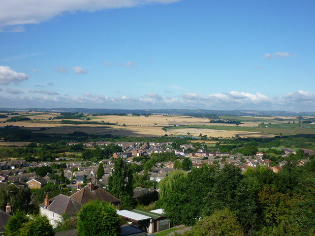
Image: © Gordon Elliott Taken: 11 Aug 2010
Taken from Bolsover 'Back Hills', Carr Vale village is the farthest extent of the housing in the foreground. Beyond that is the water of Carr Vale Flash wildfowl habitat, then the M1 motorway dividing the cornfields, and at the top of the far cornfield, amid the trees, is the ruinous Sutton Scarsdale Hall. On the far horizon is Ashover Rock. Contrast this view with contributor Andrew Hall's Image taken from almost the same spot.
Images are licensed for reuse under creativecommons.org/licenses/by-sa/2.0
Image Location
Latitude
53.225505
Longitude
-1.295963