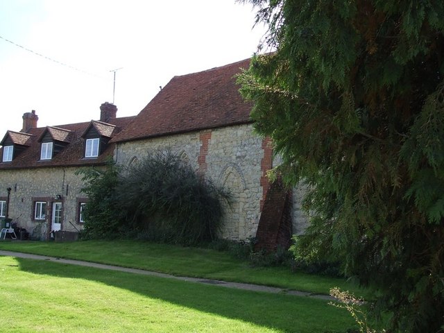
The Old Chapel, Creslow
Introduction
The photograph on this page of The Old Chapel, Creslow by Rob Farrow as part of the Geograph project.
The Geograph project started in 2005 with the aim of publishing, organising and preserving representative images for every square kilometre of Great Britain, Ireland and the Isle of Man.
There are currently over 7.5m images from over 14,400 individuals and you can help contribute to the project by visiting https://www.geograph.org.uk

Image: © Rob Farrow Taken: 7 Sep 2006
This chapel is marked on the map and edged in black suggesting it is a public building, but it looks to me as though it has been incorporated into the adjoining building. The only signs were ones informing that there was no right of way for the public - so at best it probably has a very small congregation ! Edit: According to the English Heritage Viewfinder website "The former parish church, which ceased being used in the 18th century, was first a dovecot and is now used as an outbuilding of the Manor House. " ( See http://viewfinder.english-heritage.org.uk/search/detail.aspx?uid=51561 ) However the BHO website (see http://www.british-history.ac.uk/report.aspx?compid=42572&strquery=Parish%20Creslow#s3 ) itself quoting the "History of the County of Buckingham" suggests that it had not been used as a church since the time of Elizabeth I (1558-1603). A list of the rectors (see http://met.open.ac.uk/genuki/big/eng/BKM/Creslow/rectors.html ) finishes with the appointment of Thomas Davis A.M. in 1554 - which serves to confirm this earlier date.

