Stile to Vanished Footpath
Introduction
The photograph on this page of Stile to Vanished Footpath by Des Blenkinsopp as part of the Geograph project.
The Geograph project started in 2005 with the aim of publishing, organising and preserving representative images for every square kilometre of Great Britain, Ireland and the Isle of Man.

There are currently over 7.5m images from over 14,400 individuals and you can help contribute to the project by visiting https://www.geograph.org.uk
Stile to Vanished Footpath
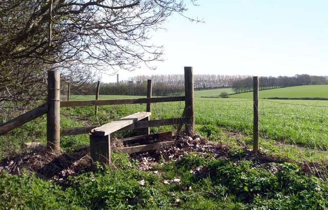
Image: © Des Blenkinsopp Taken: 6 Apr 2011
One of those "marked on the map but not there any more" ones. This stile leads you to about 200m more footpath which then vanishes into new farm tracks and the original line has been removed. This area was at one time a well known fruit growing area. It even had a big sign on the A34 directing fruit fanciers to the farms and stalls, but most of that closed down years ago and the orchard acreage is a fraction of what it was. The map still marks far more than now exists. What does remain are the lines of tall trees around the fields that were put in as wind breaks. They are a prominent feature of this small area.
Images are licensed for reuse under creativecommons.org/licenses/by-sa/2.0
Image Location
Latitude
51.60477
Longitude
-1.299931