Roadworks near Tweenaway Crossroads, Paignton
Introduction
The photograph on this page of Roadworks near Tweenaway Crossroads, Paignton by Tom Jolliffe as part of the Geograph project.
The Geograph project started in 2005 with the aim of publishing, organising and preserving representative images for every square kilometre of Great Britain, Ireland and the Isle of Man.

There are currently over 7.5m images from over 14,400 individuals and you can help contribute to the project by visiting https://www.geograph.org.uk
Roadworks near Tweenaway Crossroads, Paignton
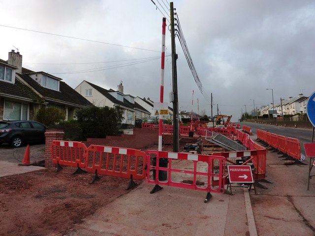
Image: © Tom Jolliffe Taken: 3 Apr 2011
The extent of the road widening can be seen in this picture on the road which runs up the hill in the Brixham direction. A large chunk of the gardens has been sliced off. I often thought that residents must have suffered from the continuous traffic noise from this very busy ring road route to Brixham, but now it will be even more noisy as the traffic will be nearer to the houses. The size of the undertaking can be judged from the huge trench that has been backfilled in moving some service pipes, but also from the power cables that have yet to be realigned off the road. The works do not finish until June 2011.
Images are licensed for reuse under creativecommons.org/licenses/by-sa/2.0
Image Location


Leaflet Map data © OpenStreetMap
Latitude
50.427838
Longitude
-3.588021