Zion Free Church, Meyrick Street
Introduction
The photograph on this page of Zion Free Church, Meyrick Street by Humphrey Bolton as part of the Geograph project.
The Geograph project started in 2005 with the aim of publishing, organising and preserving representative images for every square kilometre of Great Britain, Ireland and the Isle of Man.

There are currently over 7.5m images from over 14,400 individuals and you can help contribute to the project by visiting https://www.geograph.org.uk
Zion Free Church, Meyrick Street
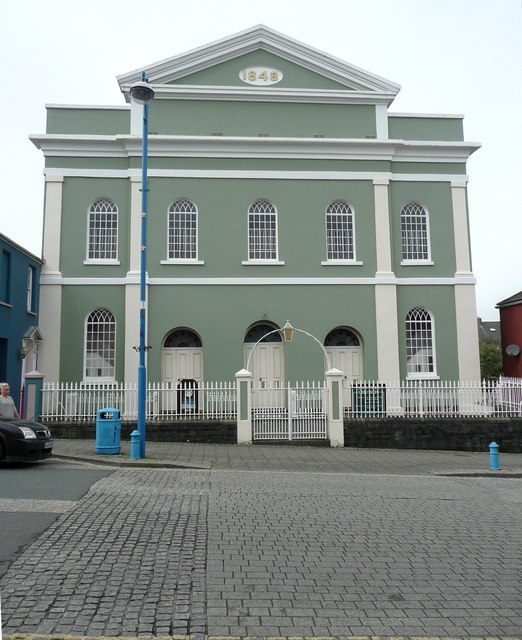
Image: © Humphrey Bolton Taken: 31 Mar 2011
Built as the Tabernacle Wesleyan Chapel 1846-8. "It was known was closed and put on the market in 1986, when it was purchased and renamed 'Zion Free Church'. ... Prior to the chapel's purchase the basement of the chapel was used as the Town's Library until it was claimed that the building was unsafe for public use.The building was bought by Mr Hugh Michael who despite the sorry and deteriorating aspects of the building, with his own hands and the help of volunteers the church has been restored to its former resplendence." (From http://www.thedock.org.uk/page_28.htm) For a view of the interior see http://www.capeli.org.uk/llun.php?src=pembroke_dock_058.jpg&teitl=Interior+Zion+Free+Church&testun=Interior+of+Zion+Free+Church%2C+Pembroke+Dock
Images are licensed for reuse under creativecommons.org/licenses/by-sa/2.0
Image Location
Latitude
51.692405
Longitude
-4.944317