Ferry Road, Pennar
Introduction
The photograph on this page of Ferry Road, Pennar by Humphrey Bolton as part of the Geograph project.
The Geograph project started in 2005 with the aim of publishing, organising and preserving representative images for every square kilometre of Great Britain, Ireland and the Isle of Man.

There are currently over 7.5m images from over 14,400 individuals and you can help contribute to the project by visiting https://www.geograph.org.uk
Ferry Road, Pennar
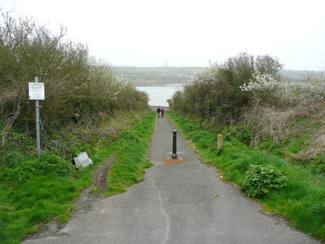
Image: © Humphrey Bolton Taken: 31 Mar 2011
This led to Bentlass Ferry, which operated between two projecting bars of shingle. The lower end of the road has been closed to traffic. The sign states the penalties for fly-tipping, but this has not stopped someone from dumping an unwanted television.
Images are licensed for reuse under creativecommons.org/licenses/by-sa/2.0
Image Location
Latitude
51.680551
Longitude
-4.950782