Woodhenge
Introduction
The photograph on this page of Woodhenge by Graham Horn as part of the Geograph project.
The Geograph project started in 2005 with the aim of publishing, organising and preserving representative images for every square kilometre of Great Britain, Ireland and the Isle of Man.
There are currently over 7.5m images from over 14,400 individuals and you can help contribute to the project by visiting https://www.geograph.org.uk

Image: © Graham Horn Taken: 26 Mar 2011
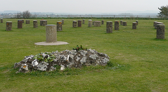
This henge was discovered in 1925, the first discovery by aerial survey. It consists of six concentric ovals with an entrance aligned towards the summer solstice from the late Neolithic or early Bronze Age. The wooden posts have all rotted but colour-coded concrete posts are now installed to aid understanding. It is best viewed from above; at ground level the posts just look confusing. This is near the centre of the circles showing an altar to the south-west of the central stone, where the remains of a 3 year old child with a cleft skull were discovered. The location suggests a ritual sacrifice. Wreaths of ivy leaves have been left there.

