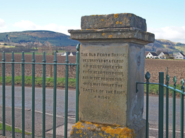
Old gatepost at Dunbarney Cemetery Extension
Introduction
The photograph on this page of Old gatepost at Dunbarney Cemetery Extension by Rob Burke as part of the Geograph project.
The Geograph project started in 2005 with the aim of publishing, organising and preserving representative images for every square kilometre of Great Britain, Ireland and the Isle of Man.
There are currently over 7.5m images from over 14,400 individuals and you can help contribute to the project by visiting https://www.geograph.org.uk

Image: © Rob Burke Taken: 2 Apr 2011
The gateposts are much older than the cemetery and I believe they have been relocated from Perth's Tay Street. (The posts and railings there were replaced by a flood wall.) The inscription on this one says "The old Perth bridge, destroyed by a flood A.D. 1621, spanned the river near this point, and in the neighbourhood was fought the "Battle of the Brig" A.D. 1547." The other post describes an event in 1633 when the King did something on a floating stage of timber on the Tay. (The inscription was hard to read when I was there, but should be readable in different light.)
Image Location


